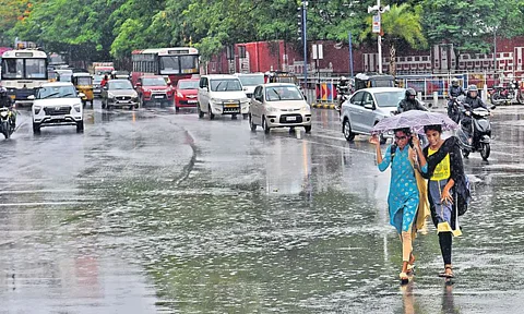


Hyderabad: Summer season in Telangana comes to an end with rains giving a much needed respite from the heat. The early arrival of the Southwest Monsoon can be termed responsible for this break.
The Southwest Monsoon usually sets in Kerala on June 1, and it advances over most parts of Northeast India by June 5. However, this year monsoon has set in over Kerala eight days before the usual date and in Mizoram, 12 days before the usual date.
The Indian Meteorological Department (IMD) has announced an early onset of monsoon in Kerala on May 24, first in 16 years. Last time the Southwest Monsoon set in this early was in 2009 on May 23.
Favourable atmospheric and oceanic conditions
The IMD stated that the early onset of the Southwest monsoon was driven by favourable atmospheric and oceanic conditions. A low-pressure area which developed over the Arabian Sea and a trough line stretching across Vidarbha enhanced moisture flow and atmospheric convection, helping the monsoon advance faster.
Dr Dharmaraju Akasapu, a scientist at the Meteorological Centre in Hyderabad, told South Check, that the atmospheric and oceanic conditions combine to speed up the normal seasonal change leading to early onset of monsoon.
“The main cause for the early monsoon onset is the strong temperature difference between the rapidly heating Indian subcontinent and the stable ocean temperatures during pre-monsoon months. This temperature gap creates stronger pressure differences that boost the monsoon circulation system. At the same time, changes in high-altitude wind patterns, including stronger westerly winds and shifts in the subtropical jet stream, help the monsoon develop,” he said.
He also added that ocean temperatures above 28°C in the Arabian Sea and Bay of Bengal increase evaporation and moisture, while neutral climate oscillations like El Niño and favorable Indian Ocean Dipole patterns avoid suppressing monsoon development.
Key atmospheric factors for early monsoon onset:
1. Intensified moisture transport across the equator.
2. Strengthened Somali Jet for better circulation. The Somali Jet is a low-level (1 to 1.5 km above sea level) cross-equatorial wind flow that moves between hemispheres. It originates near Mauritius and the northern part of Madagascar in the southern Hemisphere. It reaches the west coast of India in June. It attains maximum strength in July. Its strengthening gives rise to strong monsoon over peninsular India.
3. Optimal Madden-Julian Oscillation (3-4 Phases) phases supporting convective activity. This is a massive weather event consisting of deep convection coupled with atmospheric circulation, moving slowly eastward over the Indian and Pacific Oceans. MJO cycle spans 30 to 60 days, and it is classified into eight phases. When the phases 3-4 of the MJO is located over the Indian Ocean, it tends to enhance monsoon rainfall over the Indian subcontinent.
4. Weakened subtropical high-pressure systems.
5. Establishment of the monsoon trough creating necessary pressure gradients.
“These oceanic thermal conditions and atmospheric circulation patterns work together synergistically to create an environment conducive to premature monsoon development. This interconnected system ultimately results in earlier-than-normal monsoon onset over the Indian subcontinent,” said the IMD Scientist.
The normal monsoon onset over Telangana occurs around June 10th and lasts for approximately three to four months. In 2025, Telangana experienced a significantly early onset on May 26th. However, this does not mean that the monsoon would be longer than usual.
“The potential impact of early onset includes an extended effective monsoon period if withdrawal timing remains consistent with normal patterns, although this relationship has not been definitively established,” added Dr Dharmaraju.
The onset of monsoon over Kerala and its further advance over the country was declared following some guidelines.
a) Rainfall
After May 10, 60 per cent of the available 14 stations report rainfall of 2.5 mm or more for two consecutive days. These 14 stations are: Minicoy, Amini, Thiruvananthapuram, Punalur, Kollam, Allapuzha, Kottayam, Kochi, Thrissur, Kozhikode, Thalassery, Kannur, Kudulu and Mangalore.
The onset over Kerala can be declared on the second day if the following two conditions are also met.
b) Wind field
The depth of westerlies, winds which blow from west to east in the 30° to 60° latitudes of both hemispheres, should extend up to 600 hectopascals or hPa (a measure of atmospheric pressure).
Additionally, wind speeds at 925 hPa should range between 15–20 knots (27–37 km/h) in the region between 5°N–10°N latitude and 70°E–80°E longitude.
c) Outgoing Longwave Radiation (OLR)
The Sun heats the Earth, and the Earth, in turn, releases some of that heat back into the atmosphere and space. OLR is the terrestrial radiation released into space. Cloudy, rainy, or stormy areas emit less OLR, because clouds block the heat from escaping. Lower OLR values indicate dense cloud cover and active convection, both of which are signs of monsoon conditions.
OLR values must be below 200 wm-2 in the region between 5ºN - 10ºN Latitudes and 70ºE - 75ºE Longitudes for the Indian Southwest Monsoon.
On May 22 and 23, clouds increased over the Southeast Arabian Sea and adjoining peninsular India, with OLR being less than 200w/m on May 24. The depth of westerlies over the South Arabian Sea extended up to 4.5 km above mean sea level. The strength of the Westerlies in the lower levels is about 20-30 knots.
There has been widespread rainfall in Kerala on May 23 and May 24, satisfying the criterion for the declaration of the onset of Southwest monsoon over the State.

